A rare “high risk” has been issued as portions of the Plains face a dangerous severe weather outbreak that could produce strong, long-track tornadoes alongside giant hail and damaging wind gusts. The threat lasts throughout the day and into the overnight hours. As the situation progresses, check back here for the live updates.
(3:20 p.m. ET) A Particularly Dangerous Situation
A rare Particularly Dangerous Situation Tornado Watch has been issued across parts of Kansas, Oklahoma and Texas.This means officials have high confidence there could be strong (EF-3) to violent (EF-5) tornadoes in these areas.
Take a close look at the threat info listed in this National Weather Service update, which includes an expectation of hail the size of softballs. The NWS doesn’t use this wording lightly. A ‘particularly dangerous situation’ alert is only used in unique situations when long-lived, powerful tornadoes are in the picture.
(3:00 p.m. ET) Keep Calm and Watch Weather Alerts
Forecasts like this can seem really daunting - especially when such a wide area is at risk. It can be hard to know what to expect or where to begin when making a plan. This helpful infographic from the National Weather Service office in Norman, Oklahoma answers a lot of those questions:The big takeaway: Stay calm and stay up to date. You can get the latest alerts and information about the incoming storms on The Weather Channel App.
(2:30 p.m. ET) What Makes Today’s Forecast So Concerning?
From weather.com Digital Meteorologist Madeline Scheinost:“The environment we are seeing is ripe for supercell development. There is a lot of moisture in the area, creating an unstable atmosphere. There is also wind shear, which will help support supercell development. These supercells are expected to produce very large hail and possibly strong tornadoes.”
(MORE: What To Know About Supercells)
If that didn’t convince you, weather.com Senior Meteorologist Dina Knightly offers some extra advice: “This is a serious situation and everyone needs to have a plan on where they want to go if a tornado warning is issued. Do not delay. Charge your phones and make a plan now.”
(2:00 p.m. ET) Back In The Bullseye
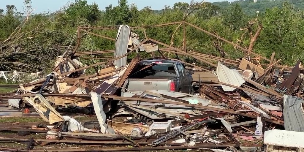
Almost the entire state of Oklahoma is under some sort of severe risk category, which includes several areas still reeling from last week’s deadly tornado outbreak. Towns like Sulphur, Holdenville and Marietta, Oklahoma that were hit hard just a few days ago are mid-cleanup efforts as they brace for yet another round of extremely dangerous weather.The same can be said for cities like Westmoreland, Kansas, where one person died and nearly two dozen homes were destroyed by a tornado on Tuesday. The people of Westmoreland find themselves back in the predicted severe area today.
For others, this potential outbreak is seemingly a long time coming. This is the first time all of Oklahoma has been under an NWS “high risk” for severe weather in five years. The last time Kansas received a “high risk” severe designation was May of 2017.
(1:30 p.m. ET) University of Oklahoma Postpones Final Exams
Today is the first day of standard finals week for many University of Oklahoma students. The university announced that any exams after 3:30 p.m. would need to be rescheduled in light of the severe weather forecast. The campus in Norman will close at that time.School officials issued a press release saying, “Students with final exams scheduled to take place after 3:30 p.m. will be contacted by their instructor to reschedule. OU Online students will continue their regularly scheduled instruction…..We will continue to monitor the weather and OU Emergency RAVE Alerts will be sent as appropriate.”
(1:00 p.m. ET) First Tornado Watch Issued
NOAA's Storm Prediction Center has issued a tornado watch from central Nebraska into north-central Kansas until 7 p.m. CDT. Additional watches will likely be issued through this afternoon and evening.(12:15 p.m. ET) School Districts Cancel After-School Events, Meetings
After-school and evening events for both Oklahoma City Public Schools and Wichita, Kansas, Public Schools have been canceled. In Oklahoma City, a planned board meeting was also canceled but in Wichita the Board of Education meeting will continue as scheduled.(12:00 p.m. ET) Will Evening Commuters Be Safe?
From weather.com senior meteorologist Jonathan Erdman: We could see severe thunderstorms kick off as soon as early afternoon in parts of central Nebraska and western Kansas.However, the peak time of concern for severe thunderstorms and tornadoes in Oklahoma and from central into eastern Kansas will be from late afternoon through late tonight.
That could be as soon as the PM rush in cities such as Lincoln, Nebraska; Wichita, Kansas; and the Oklahoma City metro areas. However, the highest chance of severe weather in those locations appears to be this evening.
Before you start your drive home today, check for any active severe weather warnings in your area. If there are severe thunderstorms in your area, you may want to consider staying put if you have considerable shelter available at work.